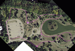
 A map is a stylized plain view of an area. One step towards this is an air photo. This exercise is to practice matching what you see on the ground to what you see on a plan, like street view on Google Earth. The participants ran in a staggard start along one of the dashed lines shown on the airphoto, but their copies did not have those lines on them. When they reached the picnic shelter they tried to draw where they had been. Their next task was to place pin flags at the places marked with red and blue dots.